How GPS Technology Works
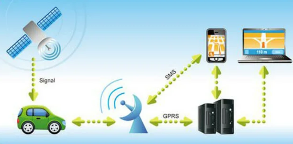
GPS technology relies on a network of satellites broadcasting precise timing and orbital data. A ground receiver collects signals from at least four satellites, measuring travel times to estimate ranges. These ranges, corrected for clock errors and atmospheric effects, enable trilateration to determine position and velocity. The system hinges on clock synchronization, ephemeris data, and error modeling. Practical use cases emerge from reliable timing and location, but open questions remain about signal integrity, multipath effects, and future enhancements.
What GPS Is and Why It Matters
Global Positioning System (GPS) is a satellite-based navigation technology that provides precise location, velocity, and time information anywhere on or near the Earth, provided there is an unobstructed line of sight to four or more satellites.
GPS basics underpin modern mobility, intelligence, and autonomy, while signal timing enables synchronized operations, timing services, and coordinated decision-making across diverse, freedom-enabling applications.
How Satellites and Receivers Collaborate to Locate You
Satellites and receivers collaborate through a coordinated exchange of signals and timing measurements to determine a precise user location. In this dynamic, satellite synchronization ensures consistent timing references, while receiver algorithms interpret multilayer data, estimate ranges, and mitigate errors. The process yields a reliable position without exposing complexity, prioritizing practical insight, robustness, and freedom to use navigation results across varying environments.
How Signals Are Processed: Timing, Trilateration, and Corrections
Signals are processed by systematically converting received radio observations into actionable position data through timing measurements, trilateration, and corrective models.
The approach relies on precise timing signals to synchronize satellite clocks with receivers, enabling distance estimates.
Trilateration computes user location from multiple ranges, while correction techniques mitigate atmospheric and instrumental biases, delivering robust positioning with quantified uncertainty for reliable navigation.
Real-World Uses, Limitations, and Future Improvements
Real-world GPS applications span critical sectors from transportation and surveying to agriculture and emergency services, with performance validated by accuracy, reliability, and availability requirements.
Practically, users encounter GPS privacy challenges and urban signal multipath, which constrain data integrity and uptime.
Future improvements focus on advanced authentication, anti-spoofing, multi-system integration, and robust urban sensing to sustain precise positioning in complex environments.
Frequently Asked Questions
How Accurate Is GPS in Urban Canyons and Indoors?
Urban canyons degrade GPS accuracy significantly, with multipath and signal obstruction causing position errors, while indoor accuracy remains constrained without auxiliary sensors. In practice, receivers rely on aiding data and sensor fusion for practical, usable localization.
Can GPS Work Without a Direct Satellite View?
Like a compass without a needle, GPS can operate without a direct satellite view through non satellite navigation. It enables indoor localization using sensor fusion and map data, though accuracy varies and reliability is reduced indoors and in dense urban spaces.
How Do Weather and Solar Activity Affect GPS Signals?
Weather interference can degrade GPS signals via atmospheric scintillation and ionospheric delays, while solar flare impact increases radio noise and GPS outage risk, especially during geomagnetic storms, prompting degraded accuracy and potential receiver outages under extreme solar activity.
What Privacy Concerns Come With GPS Tracking?
Privacy concerns arise from GPS tracking through pervasive data collection, which may reveal movements, habits, and affiliations; skeptics may doubt risk, but limited access and strict controls can mitigate privacy implications while preserving practical benefits for legitimate use.
How Will Quantum or Alternative Navigation Systems Change GPS?
Quantum navigation and alternative positioning may supplement GPS, reducing single-system dependency. They offer redundancy, potential resilience against jamming, and improved indoor accuracy, though integration challenges, standardization gaps, and cost considerations affect adoption and broad practical applicability.
Conclusion
GPS weaves a time-fine lattice across the sky, each satellite a metronome in orbit. Ground receivers listen for at least four signals, converting arrival timing into precise distances and then a three-dimensional fix. Corrections for atmospheric delay, clock drift, and satellite orbit improve fidelity, like tuning a compass with windage. The result is a stable, globally synchronized frame—navigating roads, aligning networks, or guiding Precision Time Protocol. In practice, GPS remains a robust, adaptable backbone for spatial and temporal accuracy.